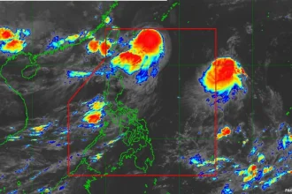

Metro Manila, Philippines – Tropical Storm Caloy (international name: Hagupit) has further intensified as it approaches the Philippine Area of Responsibility, a weather disturbance monitoring space, on Friday, May 8, the weather bureau said.
In its 11 a.m. bulletin, the Philippine Atmospheric, Geophysical and Astronomical Services Administration (PAGASA) said the storm was moving westward from 1,460 kilometers east of northeastern Mindanao.
It has maximum winds of 85 kilometers per hour (kph) near the center and gusts of up to 105 kph.
The agency said Caloy will likely enter PAR on Saturday (May 9) afternoon or evening.
“In the next 24 hours, HAGUPIT may maintain its strength or briefly reach a severe tropical storm category,” PAGASA said.
However, the agency noted that the system is less likely to directly affect the weather and sea conditions in the next three days and may downgrade into a Tropical Depression by Monday, May 11.
Meanwhile, the other low pressure area is over the coastal waters of Hinatuan, Surigao del Sur.
PAGASA said it is “unlikely” to develop into a Tropical Depression.