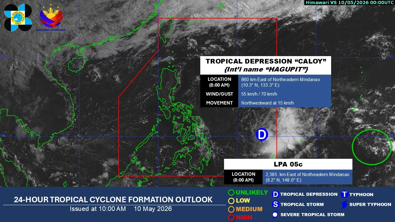

Metro Manila, Philippines – “Caloy” has weakened into a tropical depression while moving over the sea east of northeastern Mindanao, the weather bureau reported on Sunday, May 10.
In its 8 a.m. bulletin, PAGASA said “Caloy” (international name: Hagupit) has maximum sustained winds of 55 kilometers per hour (kph) and gusts of up to 70 kph.
Caloy was estimated at 770 kilometers east of Surigao City, Surigao del Norte, moving northwestward at 10 kph.
PAGASA said Caloy is unlikely to directly affect the country throughout the forecast period as it continues to move west northwestward over the Philippine Sea, far from the country’s landmass.
Caloy is forecast to further weaken by Monday, May 11.
By Sunday evening, Caloy may be located 630 kilometers east of Guiuan, Eastern Samar, before moving 500 kilometers east of Guiuan by Monday morning and 375 kilometers east northeast of the town by Monday evening.
PAGASA also warned of moderate sea conditions over several coastal waters in the next 24 hours.
Waves reaching up to 2.5 meters may affect the eastern seaboards of Northern Samar, Eastern Samar, and Siargao-Bucas Grande Islands, as well as the seaboards of Batanes.
Meanwhile, waves of up to 2.0 meters may prevail over the remaining seaboards of Ilocos Norte and Babuyan Islands; the eastern seaboards of Cagayan, Isabela, Camarines Norte, Catanduanes, Albay, Sorsogon, Dinagat Islands, Surigao del Sur, and Davao Oriental; the northern seaboards of Camarines Sur, Catanduanes, and Northern Samar; the western seaboard of Babuyan Islands; and the northwestern seaboard of Ilocos Norte.
Small vessel operators, including those running motor bancas, were warned to be cautious and refrain from sailing out to sea under these conditions.