

Metro Manila, Philippines – Two weather disturbances have the potential to develop into tropical cyclones, the weather bureau said on Monday, Sept. 9.
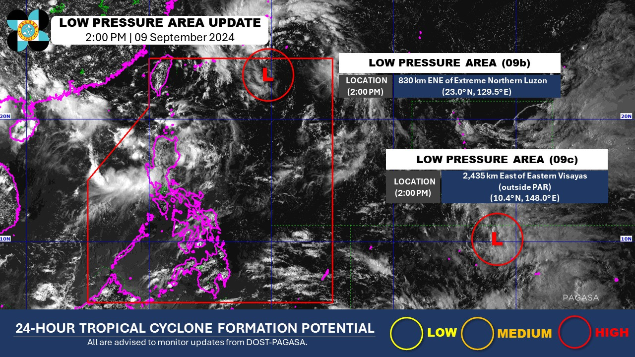
The Philippine Atmospheric Geophysical and Astronomical Services Administration (PAGASA) said a low pressure area (LPA), which has been inside the Philippine Area of Responsibility (PAR) since Sept. 8, Sunday, was spotted 830 kilometers east northeast of extreme northern Luzon.
It is moving westward to Taiwan and Batanes, the bureau said.
It said another LPA at 2,425 kilometers east of Eastern Visayas is projected to move northwest and may enter PAR by Wednesday, Sept. 11, or Thursday, Sept. 12.
Once the weather systems intensify into storms, these will be named Ferdie and Gener, the bureau said.
PAGASA said the southwest monsoon will bring rains in the western parts of northern and central Luzon on Tuesday, Sept. 10.
The rest of Luzon, as well as the Visayas and Mindanao should have generally fair and clear weather, with a possibility of isolated thunderstorms, it said.
‘ ‘7’: ‘contentWidth’: ‘100%’ ’embedCode’: ‘