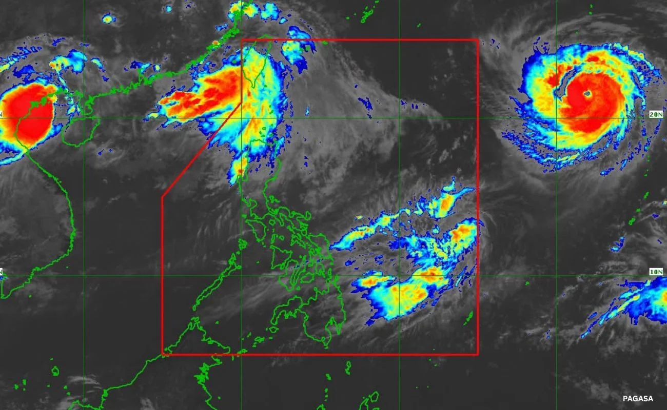


Metro Manila, Philippines — The weather bureau said the typhoon with the international name Saudel will intensify into a super typhoon ahead of a possible entry into the Philippine Area of Responsibility (PAR) on Monday, Aug. 24, while two other cyclones loom outside the country.
The Philippine Atmospheric, Geophysical and Astronomical Services Administration (PAGASA) said the cyclone will briefly traverse the Philippine Sea before exiting on Tuesday, Aug. 25, while gradually weakening into a typhoon.
Saudel is forecast to enhance the southwest monsoon upon entry into the PAR, bringing heavy rains next week.
Meanwhile, PAGASA is monitoring a tropical depression east of southern Luzon, which is unlikely to enter the PAR.
Depending on the order of entry, Saudel may be given the local name Obet or Pilandok.
A tropical depression with the international name Gaenari, formerly Neneng, remains close to the country, north of Luzon. PAGASA said it is unlikely to re-enter the PAR.
Around 6.9 million people, or 2 million families, have already been affected by nonstop rain and heavy flooding from the enhanced southwest monsoon and tropical cyclones Luis, Maymay, and Neneng.