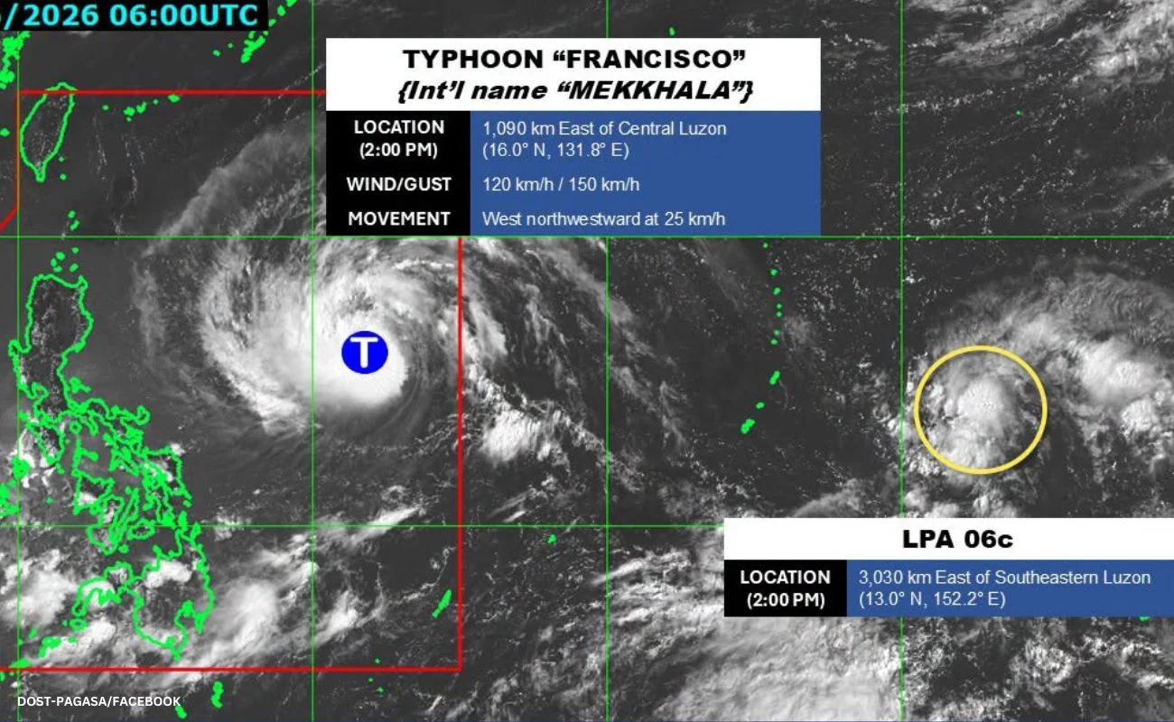

Metro Manila, Philippines – Severe tropical storm Francisco intensified into a typhoon at 2 p.m. on Sunday, the state weather bureau said.
The Philippine Atmospheric, Geophysical and Astronomical Services Administration (PAGASA) said in an earlier 11 a.m. bulletin that the cyclone will likely remain over the Philippine Sea east of Luzon during the forecast period and that it is not likely to make landfall.
No wind signals have been raised as of this writing.
PAGASA said Signal No.1 may be hoisted over northern and eastern portions of Cagayan, Babuyan Islands, and Batanes on Monday morning.
Francisco entered the Philippine Area of Responsibility on Saturday night.
The typhoon is currently located 1,090 kilometers east of Central Luzon with center winds of 120 kilometers per hour (kph) and gusts of up to 150 kph.
Meanwhile, PAGASA is monitoring another low pressure area (LPA) outside of the Philippine area of responsibility.
The agency said this LPA has a low potential of developing into a tropical depression in the next 24 hours.