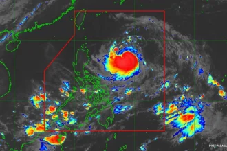
Metro Manila, Philippines – More areas are under the second to the highest storm alert as Typhoon Tino (international name: Kalmaegi) bears down on Eastern Visayas Monday afternoon, Nov. 3, the Philippine Atmospheric, Geophysical and Astronomical Services Administration (PAGASA) said.
In its 5 p.m. bulletin, PAGASA said “Tino” may hit land or pass very close to Homonhon Island or Dinagat Islands on Monday evening or early Tuesday morning.
It also raised Signal No. 4 in a number of areas in the Visayas to prepare for the expected severe impact on structures and communities.
Here are the wind signals raised as of 5 p.m. on Monday:
Signal No. 4
Visayas – the extreme southeastern portion of Eastern Samar, the southern portion of Leyte, Southern Leyte, Camotes Islands, and the northeastern portion of Bohol
Mindanao – Dinagat Islands, and Siargao and Bucas Grande Islands
Signal No. 3
Visayas – the southern portion of Eastern Samar, the southern portion of Samar, the central portion of Leyte, the northern and central portions of Cebu including Bantayan Islands, and the central and eastern portions of Bohol, the northern portion of Negros Oriental, the northern portion of Negros Occidental, Guimaras, and the eastern portion of Iloilo.
Mindanao – the rest of Surigao del Norte.
Signal No. 2
Luzon – The southern portion of Masbate, the southern portion of Romblon, and Cuyo Islands.
Visayas – The central portion of Eastern Samar, the central portion of Samar, the rest of Leyte, Biliran, the rest of Bohol, the rest of Cebu, and central portion of Negros Oriental, the rest of Negros Occidental, Siquijor, Capiz, the rest of Iloilo, Aklan, and Antique.
Mindanao – The northern portion of Surigao del Sur, the northern portion of Agusan del Sur, the northern portion of Agusan del Norte, and Camiguin.
Signal No. 1
Luzon – Albay, Sorsogon, the rest of Masbate including Ticao and Burias Islands, the southern portion of Quezon, the southern portion of Marinduque, the rest of Romblon, Oriental Mindoro, Occidental Mindoro, and the northern and central portions of Palawan including Calamian Islands and Cagayancillo Islands.
Visayas – Northern Samar, the rest of Eastern Samar, the rest of Samar, and the rest of Negros Oriental
Mindanao – The rest of Surigao del Sur, the central portion of Agusan del Sur, the rest of Agusan del Norte, Misamis Oriental, and the northern portion of Bukidnon, the northern portion of Misamis Occidental, and the northern portion of Zamboanga del Norte.
“Tino” was last spotted at 170 kilometers (km) east southeast of Guiuan, Eastern Samar, packing maximum sustained winds of 130 km per hour (kph) near the center and gustiness of up to 160 kph.
It is expected to make landfall in Leyte or Southern Leyte by early Tuesday morning, cross the Visayas and northern Palawan, emerge over the West Philippine Sea by Wednesday, and exit the Philippine Area of Responsibility by Thursday.
Risk of storm surges
PAGASA also raised storm surge warnings and advised people in coastal towns to seek safer grounds.
It said coastal areas in Dinagat Islands, Eastern Samar, Leyte, Samar, Southern Leyte, and Surigao del Norte may have storm surges of up to more than three meters.
Other areas that may be affected by storm surges include the whole Visayas and Mimaropa.
Typhoon Tino and a shear line will also trigger heavy rains across the country, mostly portions of Visayas and Mindanao.
PAGASA said torrential rains may occur in Eastern Samar, Southern Leyte, Leyte, Dinagat Islands, Cebu, Negros Occidental, Aklan, Iloilo, Guimaras, and Capiz until Tuesday afternoon.