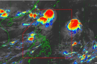

Metro Manila, Philippines – Government meteorologists warned that “Nando” may reach typhoon category on Saturday, Sept. 20, and affect the weather in northern Luzon.
In its 5 p.m. bulletin on Friday, Sept. 19, the Philippine Atmospheric, Geophysical and Astronomical Services Administration (PAGASA) also said it may raise Signal No. 1 by Saturday morning.
On Friday evening, the southwest monsoon or habagat will bring scattered rains and thunderstorms to Catanduanes, Albay, Sorsogon, Masbate, Northern Samar, and Eastern Samar.
Partly cloudy to cloudy skies with isolated rain showers or thunderstorms may be expected over Metro Manila, Ilocos Region, Cordillera Administrative Region, Calabarzon, Mimaropa, the rest of Visayas, the rest of Bicol Region, Zambales, and Bataan.
The habagat and the trough or extension of “Nando” are seen to bring strong to gale-force gusts over Bicol, Eastern Visayas, and Caraga on Saturday.
PAGASA said a storm surge warning may be raised in the coastal waters of northern Luzon on Saturday.
The bureau said the onset of heavy rains due to the combined effects of the habagat and “Nando” is expected on Sunday.
Its forecast showed “Nando” may intensify into a super typhoon by Monday before its close approach to Babuyan Islands.
PAGASA said Tropical Storm Nando was last spotted 905 kilometers (km) east of Central Luzon, packing maximum sustained winds of 85 km per hour (kph) near the center and gustiness of up to 105 kph.