
Metro Manila, Philippines – Bicol region is encountering “stormy conditions” on Saturday, Jan. 17, due to Tropical Storm Ada (international name: Nokaen), state weather bureau PAGASA said.
In its 5 p.m. bulletin, PAGASA raised Signal No. 2 in the eastern portion of Camarines Norte, the eastern and central portions of Camarines Sur, Albay, and Catanduanes.
Signal No. 1 is up in the following:
Luzon – The southeastern portion of Isabela, Aurora, the eastern portion of Quezon including Polillo Islands, Marinduque, the eastern portion of Romblon, the rest of Camarines Norte, the rest of Camarines Sur, Sorsogon, and Masbate.
Visayas – Northern Samar, the northern and central portions of Eastern Samar, the northern and central portions of Samar, and Biliran.
In its 11 a.m. bulletin, weather bureau PAGASA said Signal No. 2 covers the eastern portion of Camarines Norte, the eastern and central portions of Camarines Sur, Catanduanes, Albay, Sorsogon, and Northern Samar.
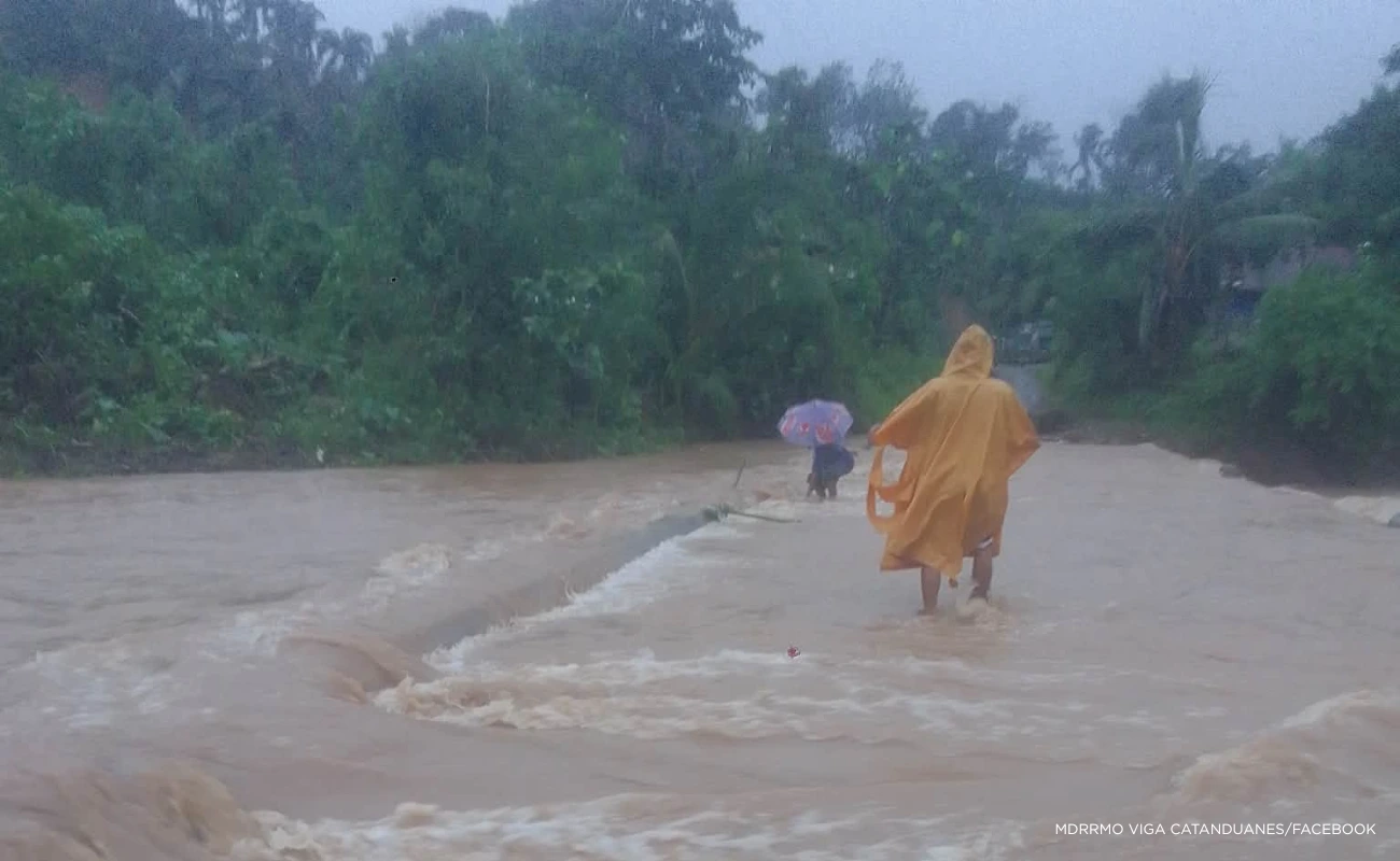
“Ada,” which was last seen over the coastal waters of Catanduanes, may dump intense rainfall over the province and Camarines Sur until Sunday afternoon, PAGASA said.
Heavy rainfall will persist in Quezon, Camarines Norte, Albay, Sorsogon, and Northern Samar.
“A further westward shift in the forecast track may result in a possible landfall over Catanduanes. Furthermore, changes in forecast track over the succeeding bulletins is possible,” the bureau said .
“Ada” will move generally northwestward on Saturday, slowly turn northward to northeastward on Sunday, before following a looping pattern over the sea east of Luzon.
PAGASA said the northeast monsoon or amihan and the periphery of “Ada” will bring strong to gale-force gusts over Batanes, Babuyan Islands, Ilocos Norte, northern and eastern mainland Cagayan, Isabela, Quirino, Quezon, Romblon, Oriental Mindoro, Aklan, Capiz, northern Cebu, Eastern Visayas, and Dinagat Islands.
A minimal to moderate risk of storm surge with peak heights reaching up two meters may also be seen within the next 48 hours over Quezon, Camarines Norte, Camarines Sur, Catanduanes, Albay, Sorsogon, Masbate, Northern Samar, Eastern Samar, Samar, and Biliran.
PAGASA said “Ada” packed maximum sustained winds of 85 kilometers per hour (kph) near the center and gustiness of up to 105 kph.
The bureau said it does not rule out further intensification of “Ada” to severe tropical storm.
The northeast monsoon is seen to weaken the tropical cyclone into a tropical depression by Tuesday.