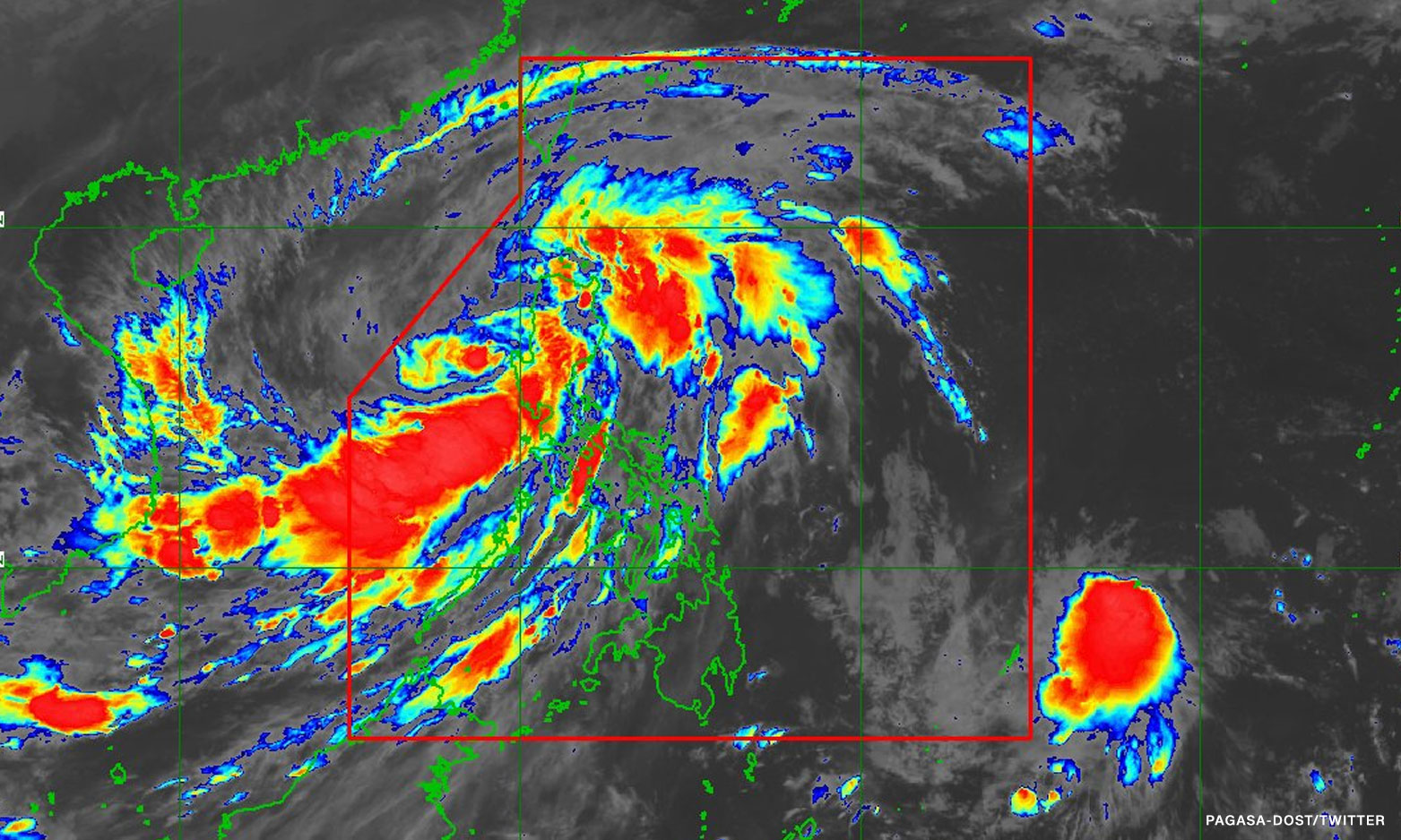

Metro Manila (CNN Philippines, October 30) — Tropical Storm Paeng kept its strength but slowed down while moving over the West Philippine Sea.
In its 11 p.m. bulletin on Sunday, the Philippine Atmospheric, Geophysical and Astronomical Services Administration (PAGASA) said Paeng was last located 255 kilometers (kms) west of Iba, Zambales.
It slowed down from 20 kilometers per hour (kph) to 10 kph and has shifted its direction to southeastward.
Paeng retained its maximum sustained winds of 85 kph near the center and gusts of up to 105 kph.
Signal No. 1 remains hoisted over the following areas where strong winds may occur: Metro Manila, Cagayan, Isabela, Quirino, Nueva Vizcaya, Apayao, Abra, Kalinga, Mountain Province, Ifugao, Benguet, Ilocos Norte, Ilocos Sur, La Union, Pangasinan, Aurora, Bulacan, Nueva Ecija, Tarlac, Pampanga, Bataan, Zambales, the western and central portions of Batangas, Cavite, Laguna, Rizal, the northwestern portion of Oriental Mindoro, the northwestern portion of Occidental Mindoro including Lubang Islands, and the northern portion of Quezon.
From Sunday evening to Monday morning, moderate to heavy rains may occur in Zambales, Bataan, Pangasinan, Batanes, and the northern portion of Cagayan including Babuyan Islands.
Light to moderate with at times heavy rains are possible over Cordillera Administrative Region, Tarlac, Pampanga, Cavite, the western portion of Batangas, Mimaropa, Western Visayas, and the rest of Cagayan Valley, according to PAGASA.
Tropical depression outside PH
PAGASA is also monitoring a tropical depression outside the country’s weather monitoring area. It was last spotted over the Pacific Ocean, 1,250 km east of northeastern Mindanao.
In a briefing past 5 a.m., weather specialist Benison Estareja said the tropical depression is not yet affecting the Philippines but it is likely to enter the country’s weather monitoring area by Monday morning.
Once the tropical depression enters the country’s weather monitoring area, it will be named Queenie, the 17th tropical cyclone this year and the fifth this October.
Estareja said is it forecast to move west northwest, heading to Eastern Visayas and will likely bring rains over Eastern Visayas, Caraga, Davao region, and parts of Bicol region.
“Pero dahil sa less conducive environment, knowing ito ‘yong lugar na dinaanan ni Paeng, nagkaroon ng paghigop ng moisture, so nabawasan na ‘yong moisture dito pero mainit pa rin. Posible itong humina as a remnant low pressure bago tumama sa kalupaan ng Eastern Visayas,” he added.
[Translation: But because of the less conducive environment, knowing this was the path of Paeng, there was a suction of moisture which lessened the steam on the area, but it is still humid. It is possible to weaken into a remnant low pressure before making landfall in Eastern Visayas.]
Paeng weakened into a tropical storm and left the landmass of Luzon early Sunday. It is seen to track north northwestward or northwestward beginning Sunday through Wednesday before turning west northwestward towards southern China.
The weather bureau also said Paeng is forecast to leave the country’s weather monitoring area by Monday afternoon or evening but may re-intensify into a severe tropical storm while over the West Philippine Sea.