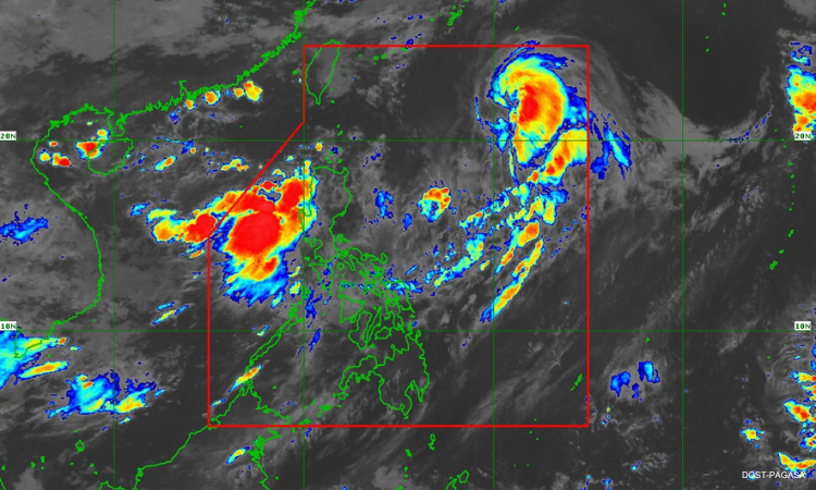

Metro Manila (CNN Philippines, June 11) — While Severe Tropical Storm Chedeng has left the Philippine Area of Responsibility (PAR) on Sunday evening, habagat or the southwest monsoon is expected to continue dumping heavy rains in many parts of the country.
In its 11 p.m. bulletin, the Philippine Atmospheric, Geophysical and Astronomical Services Administration (PAGASA) said Chedeng exited the country’s weather monitoring area while maintaining its maximum sustained winds of 110 kilometers per hour (kph) and gustiness of 135 kph.
However, within the next three days, the habagat is expected to be enhanced by the rainbands of Chedeng and a possible frontal system formed by clashing warm and cold air north of extreme Northern Luzon.
PAGASA said this enhanced habagat may continue to bring monsoon rains to Metro Manila, Bulacan, Benguet, the Ilocos Region, Zambales, Bataan, Occidental Mindoro, the northern portion of Palawan, and Antique until Monday evening.
The Ilocos Region, Zambales, and Bataan are expected to be affected until Tuesday night.
PAGASA warned flooding and rain-induced landslides are possible in these areas.
Chedeng was last seen 1,375 kms east northeast of extreme Northern Luzon, moving northeastward at 35 kph.
It is forecast to gradually weaken and maintain its movement over the sea southeast of Japan.