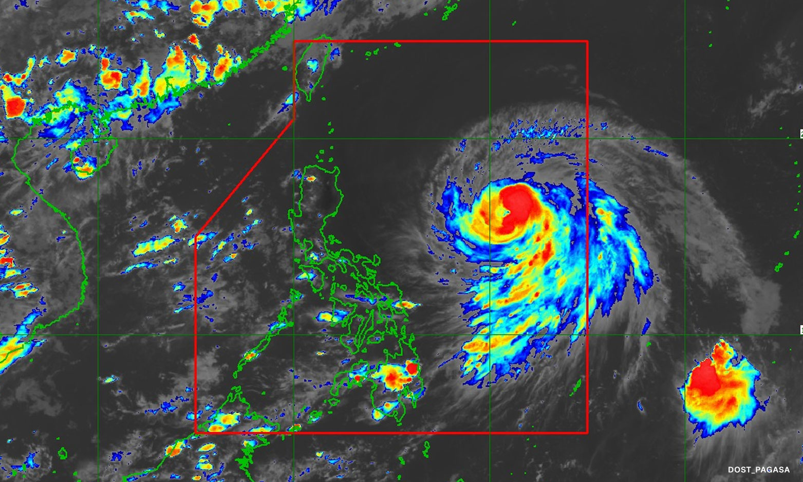

Metro Manila (CNN Philippines, June 6) – “Chedeng” has intensified into a typhoon but is unlikely to bring direct heavy rainfall over any portion of the country in the next three to five days, the state weather bureau said on Thursday.
In its bulletin issued at 5 p.m., PAGASA said Typhoon Chedeng is seen to remain far from the Philippine landmass.
“It is forecast to move generally west northwestward to northwestward until tomorrow afternoon before turning more northward the rest of tomorrow through Saturday afternoon,” it added.
The weather bureau said the tropical cyclone is expected to exit the Philippine Area of Responsibility by Monday morning.
No wind signals have been raised at this time but PAGASA said Typhoon Chedeng may result in the enhancement of the southwest monsoon.
The typhoon is also unlikely to cause rough sea conditions over the coastal waters of the country in the next 24 hours, it also said.
The center of the eye of Typhoon Chedeng was located 935 kilometers east of Central Luzon, the bureau added.
It may bring strong winds over Visayas, Romblon, Occidental Mindoro, the northern portion of Palawan including Kalayaan, Calamian, and Cuyo Islands, Surigao del Norte, Dinagat Islands, and Camiguin on Friday.
The Visayas, CALABARZON, MIMAROPA, Bicol Region, Camiguin, and Dinagat Islands are also expected to experience gusty conditions on Saturday, PAGASA said.