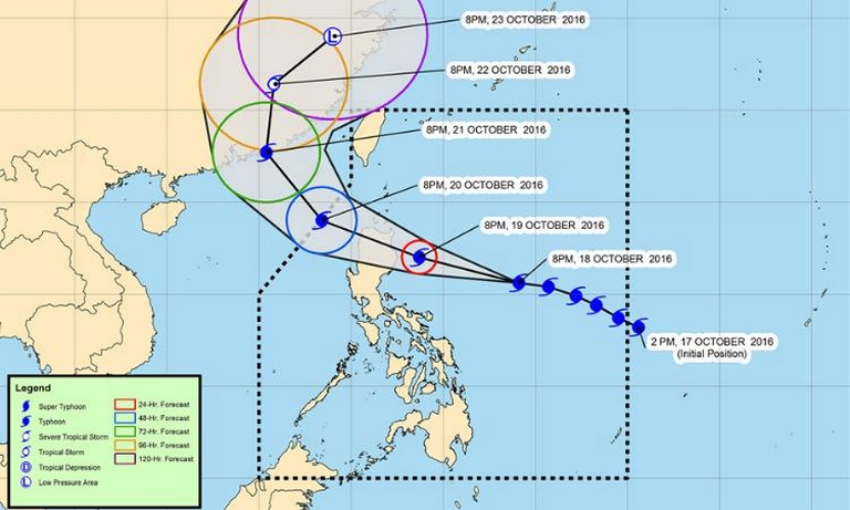
Metro Manila (CNN Philippines) — Typhoon Lawin (international name: Haima) continued to gain strength as it moved toward the general direction of northern Luzon, according to the latest weather bureau advisory late Tuesday evening.
Based on the Philippine Atmospheric Geophysical and Astronomical Services Administration’s (PAGASA) 11 p.m. update, Lawin would intensify further before it would hit Cagayan area early Thursday morning.
It was then expected to cross Apayao and Ilocos Norte.
As of 12 a.m. Wednesday, Lawin’s center was 715 km east of Baler, Aurora.
It had maximum sustained winds of up to 195 kph with gustiness of up to 240 kph.
Signal No. 2 has been raised over:
Cagayan
Isabela
northern Aurora
Signal No.1:
Calayan group of islands
Batanes group of islands
Ilocos Norte
Ilocos Sur
Apayao
Abra
Kalinga
Mt. Province
Ifugao
La Union
Benguet
Tarlac
Nueva Vizcaya
Quirino
Pangasinan
Nueva Ecija
the rest of Aurora
Zambales
Pampanga
Bulacan
northern Quezon including Polillo Islands, Camarines Norte, Camarines Sur, and Catanduanes
Lawin is expected to leave the Philippine Area of Responsibility by Friday evening.


