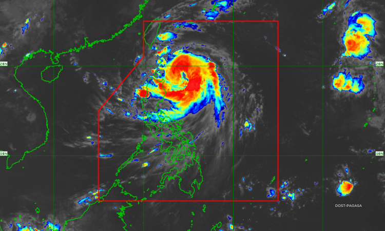

Metro Manila, Philippines – Cyclone Julian has intensified into a typhoon, the state weather bureau said on Sunday, Sept. 29.
In its 5 p.m. bulletin, the Philippine Atmospheric, Geophysical and Astronomical Services Administration (PAGASA) said Julian has maximum sustained winds of 120 kilometers per hour (kph) and a gustiness of 150 kph.
It is moving 15 kph north northwestward.
Wind signals
Wind Signal No. 3 is up over Batanes and the northeastern portion of Babuyan Islands.
PAGASA raised Signal No. 2 over mainland Cagayan, the rest of Babuyan Islands, Apayao, and the northern and central portions of Ilocos Norte.
Signal No. 1, meanwhile, is in effect over the rest of Ilocos Norte, Ilocos Sur, La Union, Abra, Kalinga, Ifugao, Mountain Province, Benguet, Isabela, Nueva Vizcaya, Quirino, and the northern and central portions of Aurora.
Rainfall outlook
For Sunday until Monday, intense to torrential rains, or over 200 millimeters is expected over Batanes, Babuyan Islands, and Ilocos Norte.
About 100 to 200 millimeters, on the other hand, may be dumped over mainland Cagayan, Ilocos Sur, and Abra.
Apayao, La Union, Mountain Province, and Benguet, Pangasinan, Zambales, and Bataan may experience moderate to heavy rains or 50 to 100 millimeters of rain.
Julian may further strengthen into a super typhoon.
Based on PAGASA’s track forecast, the typhoon is likely to make landfall over Batanes and/or Babuyan Islands on Monday.