
Metro Manila, Philippines — Signal No. 1 is up over some areas in Luzon due to severe tropical storm Carina, the Philippine Atmospheric, Geophysical and Astronomical Services Administration (PAGASA) said early Monday morning, July 22.
In a 5 a.m. bulletin, PAGASA warned that minimal to minor impacts from strong winds may occur within areas under the storm alert.
“Carina” would also bring heavy to intense rains over the extreme northeastern portion of mainland Cagayan on Monday.
Moderate to heavy rains are expected over Babuyan Islands and the eastern portions of mainland Cagayan and Isabela.
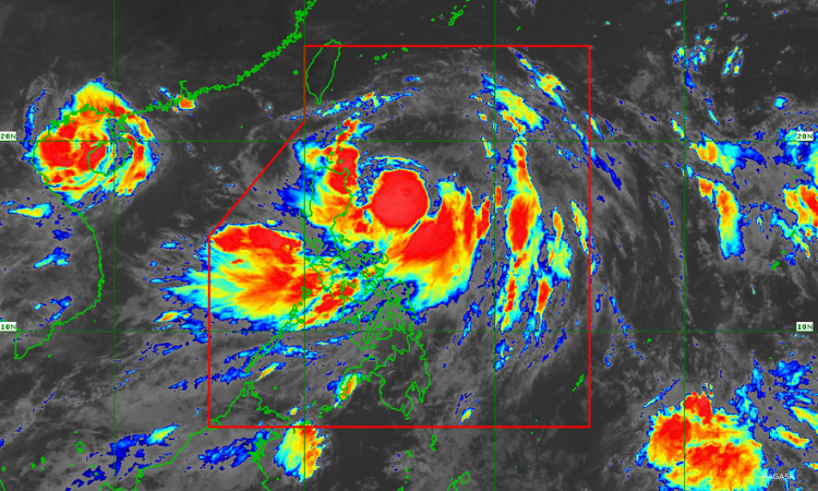
The severe tropical storm was last spotted 420 kilometers (km) east of Tuguegarao City, Cagayan.
It was packing maximum sustained winds of 100 km per hour (km/h) near the center and gustiness of up to 125 km/h.
PAGASA said “Carina” is enhancing the southwest monsoon, or habagat, that may bring moderate to heavy rains over La Union, Pangasinan, Benguet, Zambales, Bataan, and Occidental Mindoro on Monday.
The enhanced habagat may also cause moderate to occasionally heavy rains over Metro Manila, Ilocos Norte, Ilocos Sur, Abra, Tarlac, Pampanga, Bulacan, Nueva Ecija, Rizal, Cavite, Batangas, and Calamian Islands on Monday.
The storm would also bring strong gale-force gusts over Mimaropa, Bicol Region, Western Visayas, Northern Samar, and the northern portion of Samar.
Government meteorologists forecast “Carina” to intensify into a typhoon within 24 hours. The tropical cyclone is expected to leave the Philippine Area of Responsibility by Wednesday evening or early Thursday morning. It remains offshore. — JRM