
Metro Manila (CNN Philippines, September 2) — Signal No. 1 is still hoisted over Batanes as Typhoon Hanna maintained its strength while moving westward over the sea east of Taiwan, the state weather bureau said Saturday.
According to the 11 p.m. bulletin of the Philippine Atmospheric, Geophysical and Astronomical Services Administration (PAGASA), minimal to minor impacts from strong winds are possible in Batanes.
It said Typhoon Hanna was spotted 295 km northeast of Itbayat, Batanes and kept its maximum sustained winds of 140 kilometer per hour (kph) near the center and gustiness of up to 170 kph.
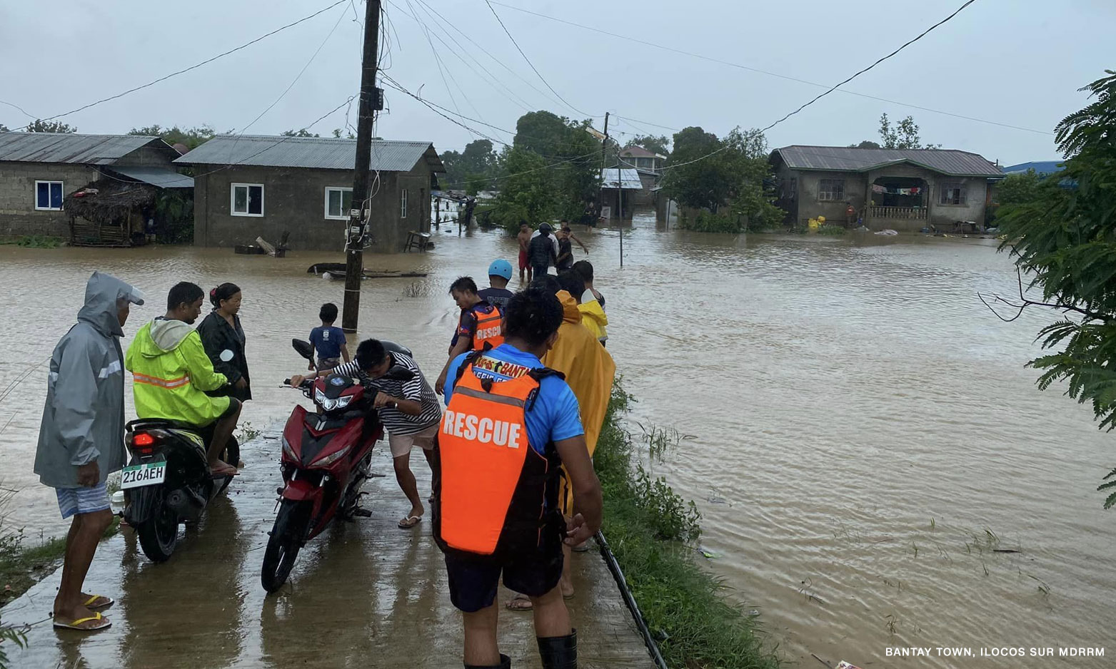
PAGASA also said the southwest monsoon or habagat enhanced by the storm will bring occasional to monsoon rains over the western portion of Luzon and Antique in the next three days.
The southwest monsoon is expected to bring gusty conditions from Saturday to Sunday over Batanes, Babuyan Islands, Ilocos Region, Cordillera Administrative Region, Nueva Vizcaya, Zambales, Pampanga, Bataan, Aurora, Bulacan, Metro Manila, Calabarzon, Mimaropa, Bicol Region, Western Visayas, and the northern portion of Eastern Visayas.
A gale warning has also been raised in all seaboards of Luzon, Northern Quezon, and Western Visayas due to continuous rainfall.
Meanwhile, the floodgates of Ipo, Ambuklao and Binga dams were opened on Saturday at 6 a.m. due to the heavy rains brought by Hanna.
PAGASA data showed that one gate was opened at the Ipo Dam in Bulacan at 0.30 meters.
The Ambuklao Dam in Benguet had four gates opened at 2.0 meters. On the other hand, the Binga Dam, also in Benguet, had six gates opened at 3.0 meters.
PAGASA said Hanna is forecast to exit the Philippine Area of Responsibility on Monday. It is expected to have weakened into a tropical depression by late Wednesday or early Thursday.