Metro Manila (CNN Philippines, September 15) — The new standard map that will counter China’s 10-dash-line map is crucial in terms of determining the extent of Philippine territory that is free for safe navigation and implementing environmental protection programs, the Armed Forces of the Philippines (AFP) said on Friday.
AFP Spokesperson Colonel Medel Aguilar said the map which abides by the United Nations Convention on the Law of the Sea (UNCLOS) will be important in giving Filipinos “pride and responsibility” to preserve the territory.
READ: New standard map to follow PH rights under 2016 arbitral ruling, UNCLOS – NSC
“It is important for all of us – all Filipinos – to understand the map. This gives us pride, the responsibility to make sure that this part of the world that belongs to us will be preserved, not just for the present generation but for generations to come,” Aguilar told CNN Philippines’ The Source.
Aguilar added that the map is “not only about the rights” but also about environmental protection programs that are implemented in the contested areas.
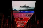
A Senate panel will craft an updated Philippine map in response to the 10-dash-line shown on China’s new standard national map which claims nearly the entire South China Sea as part of its territory.
The area overlaps the exclusive economic zones (EEZ) of the Philippines, as well as those of Malaysia, Brunei, Vietnam, and Indonesia.