

Metro Manila, Philippines – A short list of coordinates will not correctly depict the limits of the country’s exclusive economic zone (EEZ), the National Mapping and Resource Information Authority (NAMRIA) said on Wednesday, Feb. 18.
Two weeks ago, Sen. Rodante Marcoleta sought for the EEZ coordinates when the Senate tackled a resolution condemning the statements of the Chinese embassy against some Filipino officials.
“The reason why I am asking the gentleman for the metes and bounds to our claim on our maritime rights is because until today, I would like to believe that there has not been any specific computation or coordinates of the West Philippine Sea,” Marcoleta said during the Feb. 2 plenary session.
Under international law, the EEZ extends up to 200 nautical miles from the archipelagic baselines.
In its statement, the NAMRIA explained that it creates a “continuous curved boundary,” which is similar to the circle’s edge and not a polygon made of straight lines.
“Because of this, a short list of coordinates would not accurately describe the maritime limit,” the agency said.
“The boundary is therefore represented through precise geospatial data derived from the archipelagic baselines defined in RA 9522, allowing navigation systems and mapping software to determine the limit correctly,” referring to the Philippine Archipelagic Baselines Law.
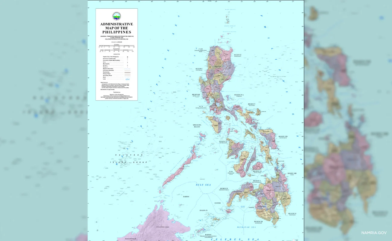
The Philippines calls waters within the EEZ as the West Philippine Sea, a label which the NAMRIA has placed consistently across its official maps and charts, including administrative maps, topographic maps, thematic maps, and nautical charts used for navigation.
Also within the West Philippine Sea are the Kalayaan Island Group, part of the disputed Spratlys, and Bajo de Masinloc, also known as Scarborough Shoal, as the country exercises sovereignty and jurisdiction over these features.
By law, these are classified as a “Regime of Islands” under the Republic of the Philippines consistent with Article 121 of the United Nations Convention on the Law of the Sea (UNCLOS).
The mapping agency said the nautical charts follow international hydrographic standards, are utilized by Philippine and foreign vessels navigating waters under Manila’s jurisdiction, and have been submitted to the International Hydrographic Organization and other international technical bodies.
“Through these established technical processes, Philippine geographic information is integrated into the global maritime record and supports safe navigation and responsible maritime activity,” it said.
China does not recognize the 2016 arbitral award that dismissed Beijing’s expansive claims over almost the entire South China Sea, which is also claimed in part by Taiwan, Vietnam, Malaysia, and Brunei.


