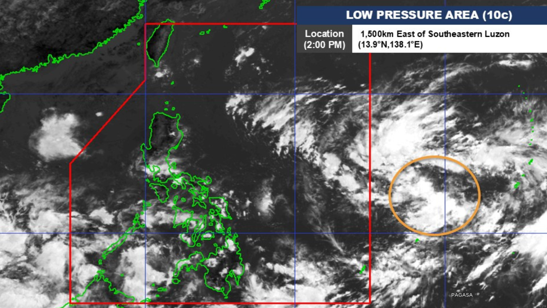

Metro Manila, Philippines – A low pressure area (LPA) outside the Philippine Area of Responsibility may enter the country’s weather monitoring zone and intensify into a cyclone, the Philippine Atmospheric, Geophysical, and Astronomical Services Administration said on Saturday, Oct. 19.
Forecasters last spotted the LPA east of Southeastern Luzon.
PAGASA said the weather disturbance will be named ‘Kristine’ once it becomes a cyclone.
The weather bureau is also not ruling out chances for the storm to hit land over Luzon.
“Asahan po natin next week, makararanas ang Luzon, kabuuan ng Visayas at ilang parte ng Mindanao ng pag-ulan,” Chenel Dominguez, weather forecaster, said.
[Translation: Expect next week that Luzon, Visayas, and parts of Mindanao will experience rains]
Meanwhile, the Intertropical Convergence Zone is currently triggering scattered rains over Southern Mindanao such as Zamboanga Peninsula, Davao Occidental, and the Bangsamoro region.
Isolated rains may also prevail over the Cagayan Valley and Aurora due to easterlies.