
Metro Manila, Philippines — The northernmost province of Batanes remains under wind signal number 1 even as typhoon Carina has exited the country, weather bureau Philippine Atmospheric, Geophysical and Astronomical Services Administration said in its 5 p.m. bulletin.
PAGASA said “Carina” was out of the Philippine Area of Responsibility at 6:20 a.m., passed through Taiwan, and was heading towards southeastern China.
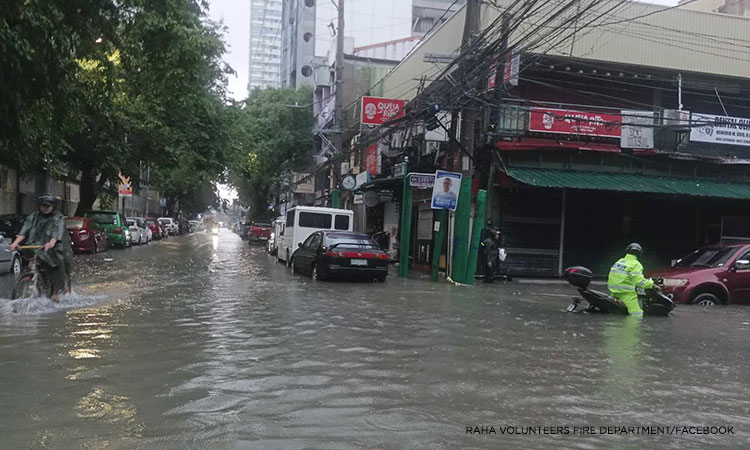
Government meteorologists said “Carina” is still enhancing the southwest monsoon, or habagat, that dumps moderate to intense rainfall in western Luzon.
The storm alert in Batanes was downgraded to Signal No. 1, with PAGASA warning residents in the province of minimal to minor impacts from strong winds.
The enhanced habagat will also bring strong to gale-force gusts over Batanes, Babuyan Islands, Ilocos Region, Cordillera Administrative Region, Nueva Vizcaya, Quirino, the eastern portion of Isabela, Central Luzon, Metro Manila, Calabarzon, Mimaropa, Bicol Region, Western Visayas, Negros Occidental, and Northern Samar until Friday.
“Carina” and habagat will affect sea conditions in the seaboards of Luzon. The weather bureau advised small vessels against setting sail.
New LPA
Meanwhile, a new low pressure area (LPA) was spotted off southeastern Mindanao on Thursday afternoon.
Forecasters said there’s a low chance for it to develop into a tropical depression within the next 24 to 48 hours.
“Wala itong direktang epekto sa anumang bahagi ng ating bansa,” PAGASA forecaster Ana Clauren-Jorda said.