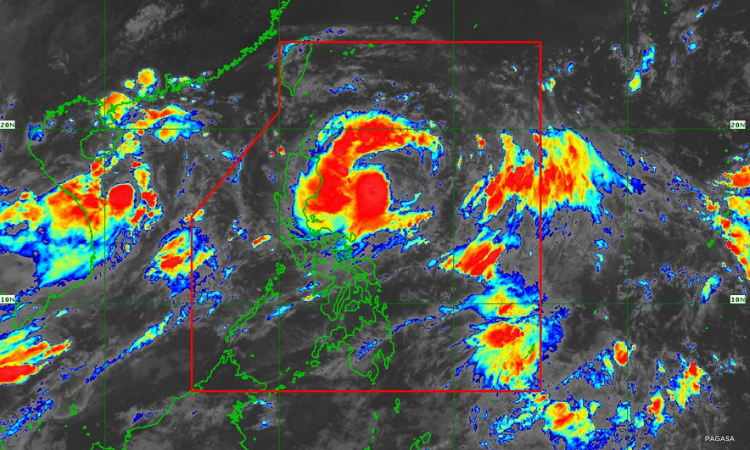

Metro Manila, Philippines — “Carina” (international name: Gaemi) intensified into a severe tropical storm on Sunday evening July 20, the Philippine Atmospheric, Geophysical and Astronomical Services Administration (PAGASA).
In an 11 p.m. bulletin, PAGASA raised Signal No. 1 over the northeastern portion of Cagayan (Santa Ana) due to “Carina”. Government meteorologists warn minimal to minor impacts due to strong winds may be experienced within the area.
According to PAGASA, heavy to intense rains are possible over the extreme northeastern portion of mainland Cagayan from Sunday night to Monday night.
Moderate to heavy rains are also expected over Babuyan Islands and the eastern portions of mainland Cagayan and Isabela.
“Carina” would enhance the southwest monsoon, or habagat, that may bring moderate to heavy rains over La Union, Pangasinan, Benguet, Zambales, Bataan, and Occidental Mindoro on Monday.
The enhanced habagat may also bring moderate to occasionally heavy rains over Metro Manila, Ilocos Norte, Ilocos Sur, Abra, Tarlac, Pampanga, Bulacan, Nueva Ecija, Rizal, Cavite, Batangas, and Calamian Islands on Monday.
Due to the strengthened habagat, strong to gale-force gusts are expected over Mimaropa, Bicol Region, Western Visayas, Northern Samar, and the northern portion of Samar (province) from Sunday night to Monday night.
Weather forecasters see “Carina” intensifying into a typhoon within 24 hours, before leaving the Philippine Area of Responsibility by Wednesday night or early Thursday morning. PAGASA said rapid intensification is possible.
The tropical storm was last seen 385 kilometers (km) east of Casiguran, Aurora. Track forecast shows the tropical cyclone would remain offshore.