
Metro Manila (CNN Philippines, August 23) — A low pressure area inside the Philippine Area of Responsibility could turn into a storm in the coming days, according to the Philippine Atmospheric, Geophysical and Astronomical Services Administration (PAGASA).
“Base sa pinakahuling datos natin, hindi natin inaalis yong posibilidad na ito ay maging bagyo sa mga susunod na araw,” PAGASA weather specialist Obet Badrina said in a 4 a.m. briefing on Wednesday.
[Translation: Based on our latest data, we are not ruling out the possibility of this LPA turning into a storm in the coming days.]
PAGASA said the trough or extension of the LPA may bring cloudy skies with scattered rain showers and thunderstorms to Cagayan Valley and the Cordillera Administrative Region.
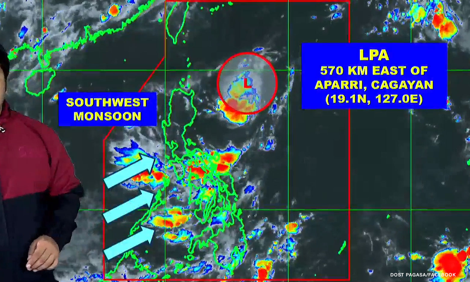
The same weather condition is also forecast in parts of the Visayas, Mindanao, Bicol Region, Mimaropa, Zambales, Bataan, and Quezon, but caused by the southwest monsoon or habagat.
Metro Manila and the rest of Luzon may expect partly cloudy to cloudy skies with isolated rain showers or thunderstorms due to the habagat and localized thunderstorms.
The LPA, which formed on Monday, was last spotted 570 kilometers east of Aparri, Cagayan, Badrina said.