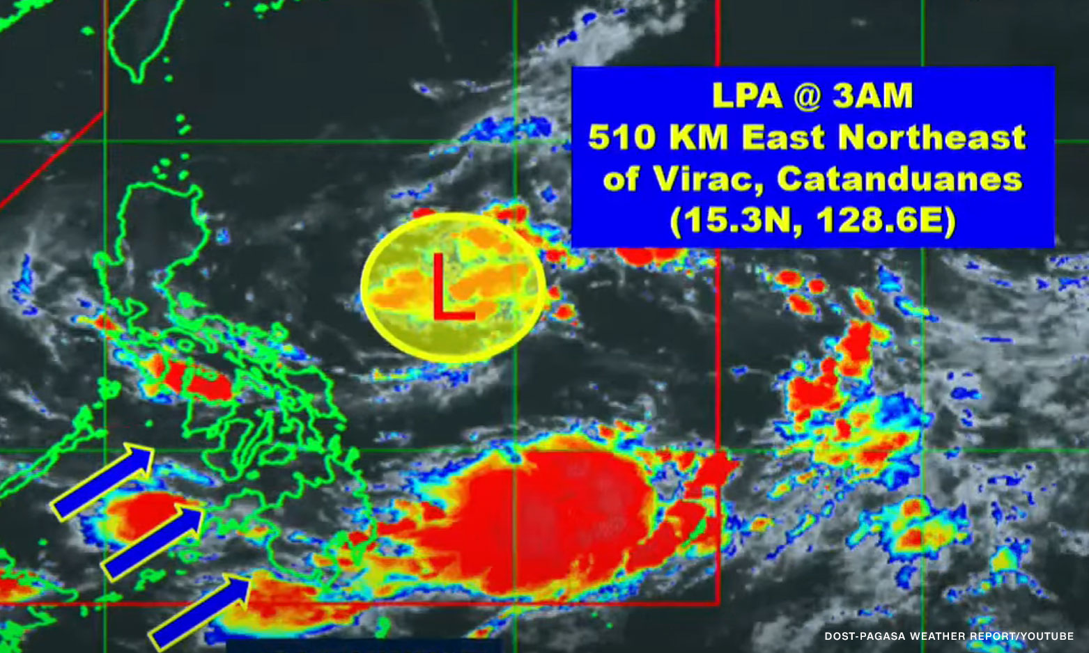

Metro Manila (CNN Philippines, July 12) — The state weather bureau is not ruling out the possibility that the low pressure area spotted east of Virac, Catanduanes may develop into a typhoon.
During an early morning briefing, Obet Badrina, a PAGASA weather specialist, said the cloud cluster that the agency was monitoring developed into a low pressure area on Tuesday.
“Patuloy na nasa karagatan at hindi inaalis sa posibilidad na ito ay maging bagyo,” he said. “Bagama’t in the next 24 hours, maliit pa naman ‘yung chance.”
[Translation: It remains over the ocean and we are not eliminating the possibility of it becoming a typhoon. Although in the next 24 hours, the chance is still slim.]
Badrina said the LPA will bring rains over Luzon, especially in the eastern part.
The Visayas and Mindanao will also experience cloudy skies and rainshowers due to the southwest monsoon or habagat.
A similar situation will prevail over Mimaropa and the Bicol region due to habagat and LPA, he added.
Northern and Central Luzon, meanwhile, will continue to experience hot weather, but there are chances of rain in the afternoon and evening.