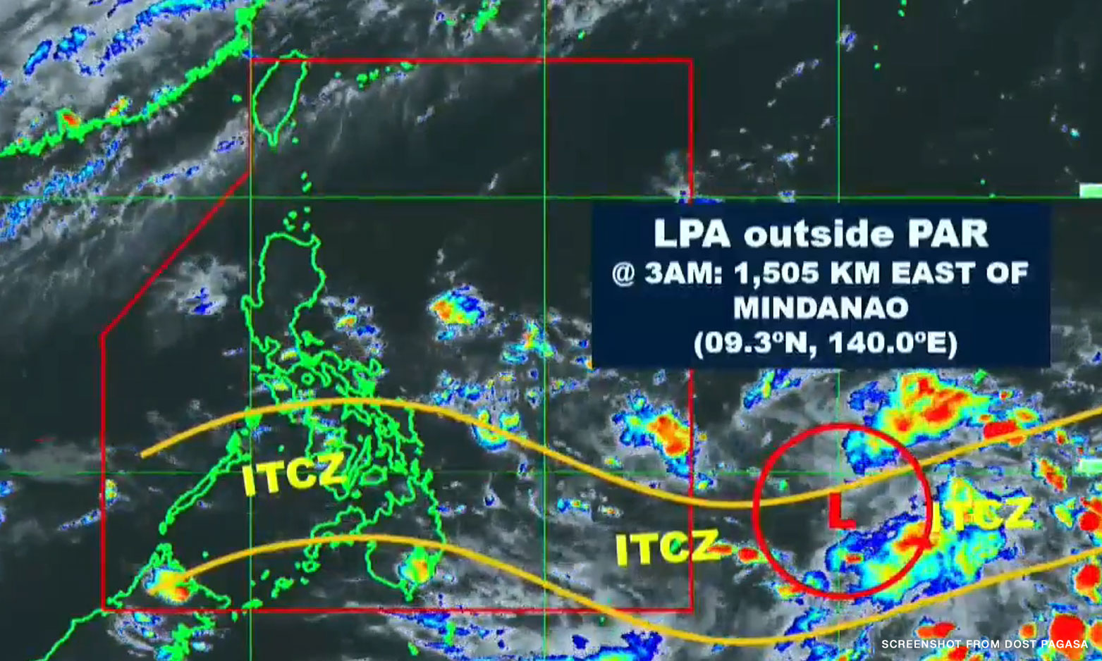

Metro Manila (CNN Philippines, June 24) — A low pressure area (LPA) outside the Philippine Area of Responsibility (PAR) is being monitored as it might develop into a tropical cyclone in the coming days, the Philippine Atmospheric, Geophysical and Astronomical Services Administration (PAGASA) said on Saturday.
The LPA was last spotted at 1,505 kilometers east of Mindanao, embedded along the Intertropical Convergence Zone (ITCZ), an area where trade winds of the northern and southern hemispheres come together, it said.
“Hindi natin tinatanggal ‘yong tiyansa o posibilidad ng nasabing low pressure area na maging isang ganap na bagyo sa mga susunod na araw,” weather forecaster Daniel James Villamil said.
“Sa ngayon, wala pa naman itong direktang epekto sa anumang bahagi ng bansa,” he added.
[Translation: We are not removing the chance or possibility of the LPA to turn into a storm in the coming days. Currently, it has no direct effect on any parts of the country.]
But the ITCZ is affecting weather conditions of southern Luzon, the Visayas, and Mindanao, the weather bureau said.
PAGASA said cloudy skies with scattered rain showers and thunderstorms may be experienced over Quezon, Bicol region, Eastern Visayas, Dinagat Islands, and Surigao del Norte.
Villamil said locals in Quezon and the provinces in Bicol may expect rain fall from afternoon to evening.
Partly cloudy to cloudy skies with isolated rain showers or thunderstorms caused by the ITCZ and localized thunderstorms are expected in Metro Manila and the rest of the country, PAGASA added.
State meteorologists warned of possible flash floods or landslides during severe thunderstorms, especially in low-lying and flood-prone areas.