
Metro Manila (CNN Philippines, May 22) — Parts of the country may experience rains on Monday due to the southwesterly windflow while a cyclone that may develop into a super typhoon might enter the Philippine Area of Responsibility on Friday, the state weather bureau said.
In the 4 a.m. update, Philippine Atmospheric, Geophysical and Astronomical Services Administration (PAGASA) weather specialist Obet Badrina said some areas, specifically Palawan and Occidental Mindoro, may experience rains on Monday due to the southwesterly windflow.
Other parts of Luzon will generally experience hot weather, but thunderstorms are also expected during the afternoon until evening as the country transitions into the rainy season. Isolated rain showers and thunderstorms may also occur in parts of Visayas and Mindanao, he added.
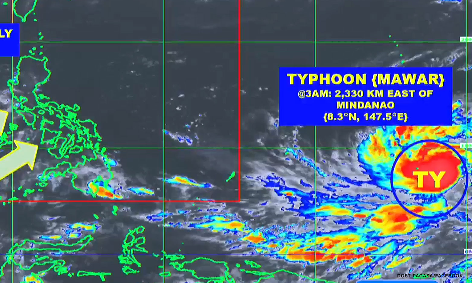
Meanwhile, Typhoon Mawar was last spotted 2,330 kilometers east of Mindanao, packing maximum sustained winds of up to 130 kilometers per hour (kph) and gustiness of up to 160 kph.
PAGASA again warned that Mawar may intensify into a super typhoon as it continues to traverse bodies of water.
Mawar is projected to enter the country’s weather monitoring area on Friday and it will be called Betty, the second tropical cyclone this year.
The weather disturbance is expected to enhance the southwest monsoon, or habagat, which will bring rains over the western section of the country during the weekend, Badrina said.