
In an interview with CNN Philippines, Catanduanes Governor Joseph Cua warned of possible landslides in the municipalities of San Miguel, Viga, and Panganiban.
Metro Manila (CNN Philippines, October 27) —Tropical Storm Paeng maintained its strength and is now moving slowly westward, while more areas in Luzon and the Visayas are placed under Signal No. 1, the state weather bureau said Thursday.
PAGASA weather specialist Raymond Ordinario said that Paeng’s movement “will definitely affect the preparation for Undas and the long weekend.”
It will likely exit the country by Wednesday or Thursday next week because once it crosses the coastal waters of extreme Northern Luzon by Tuesday, it would take at least two days before it moves away, he added.
In its 11 p.m. weather bulletin, the Philippine Atmospheric, Geophysical and Astronomical Services Administration (PAGASA) placed the following Luzon areas under Signal No. 1: Catanduanes, Albay, Sorsogon, Masbate including Ticao and Burias Islands, Camarines Sur, the eastern portion of Romblon (San Fernando, Cajidiocan, Magdiwang, Romblon, Corcuera, Banton), Marinduque, Camarines Norte, Polillo Islands, and the southern portion of mainland Quezon (Atimonan, Padre Burgos, Pagbilao, Quezon, Alabat, Perez, Unisan, Gumaca, Plaridel, Agdangan, Macalelon, Pitogo, General Luna, Catanauan, San Francisco, San Andres, Mulanay, San Narciso, Buenavista, Lopez, Calauag, Guinayangan, Tagkawayan, Mauban).
In the Visayas, the following areas are also under the lowest tropical cyclone wind signal: Eastern Samar, Northern Samar, Samar, Biliran, and the northern portion of Leyte (San Isidro, Calubian, Tabango, Leyte, Capoocan, Carigara, San Miguel, Babatngon, Tacloban City, Santa Fe, Palo, Villaba, Kananga, Jaro, Alangalang, Pastrana, Dagami, Tanauan, Tabontabon, Tolosa, Tunga, Barugo)
In the next 24 hours, the northeast monsoon, or amihan, will bring strong to gale-force winds over Batanes, Babuyan Islands, Quezon, Bicol Region, Marinduque, Romblon, and the northern portions of mainland Cagayan, Apayao and Ilocos Norte, PAGASA said.
Under Signal No. 1, winds of 39-61 kilometers per hour and intermittent rains may be expected within 36 hours. This may bring light damage to medium to high-risk structures and slight damage to some houses of very light materials or makeshift structures in exposed communities.
PAGASA said Paeng is expected to further intensify into a severe tropical storm within 24 hours and become a typhoon by Saturday. It is likely to pass close to Catanduanes that day and make landfall on Sunday in the eastern coast of Aurora or Quezon.
PAGASA also warned of flooding and rain-induced landslides in areas that are highly or very highly susceptible to hazards.
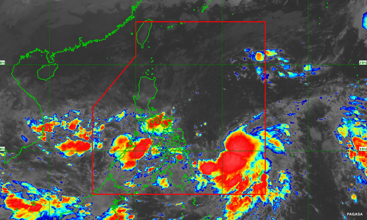
Paeng was last located 485 kilometers east of Borongan City, Eastern Samar, moving west northwestward at 10 kph. It recorded stronger maximum winds of 65 kph near the center and gustiness of up to 80 kph.
PAGASA earlier warned that in a worst-case scenario, Paeng may do a southward shift and bring more rains over Central Luzon, Calabarzon and Metro Manila, with its effect to be felt until Monday.