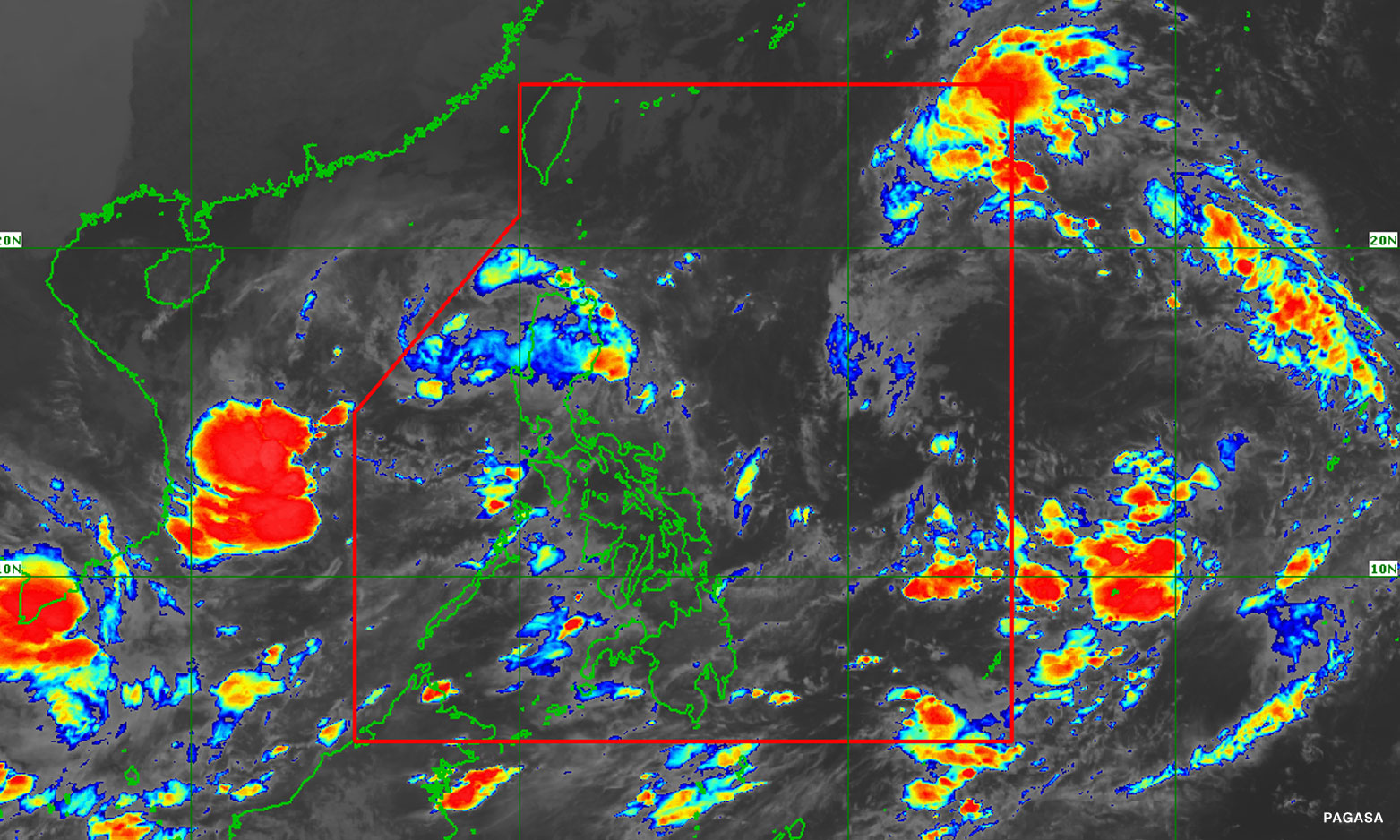

In its 5 p.m. update, PAGASA said the center of the storm was located 1,030 kilometers east of extreme northern Luzon and is moving west at 30 kilometers per hour (kph).
No storm signals have been raised yet, but Tropical Cyclone Wind Signal No.1 could be raised by Friday over the eastern portion of Northern Luzon, according to PAGASA.
“Per latest track and intensity forecast, the most likely highest wind signal that will be hoisted is Wind Signal No.2,” it said.
Metro Manila (CNN Philippines, October 13) — The tropical depression earlier monitored east of Luzon has entered the country’s weather monitoring system, it was confirmed on Thursday.
The state weather bureau added that Neneng has maximum sustained winds of 55 kph near the center and gustiness of up to 70 kph.
“The tropical depression east of Northern Luzon entered the Philippine area of responsibility at 12:00 noon today and was given the domestic name #NenengPH,” the Philippine Atmospheric, Geophysical and Astronomical Services Administration (PAGASA) said in a Facebook post.
Neneng follows Tropical Depression Maymay which weakened into a low pressure area, and was last spotted over the coastal waters of Casiguran, Aurora.
“Neneng is forecast to further intensify while moving over the Philippine Sea and may reach tropical storm category by Saturday. The possibility of further intensification prior to its close approach to Extreme Northern Luzon is not ruled out, PAGASA said.