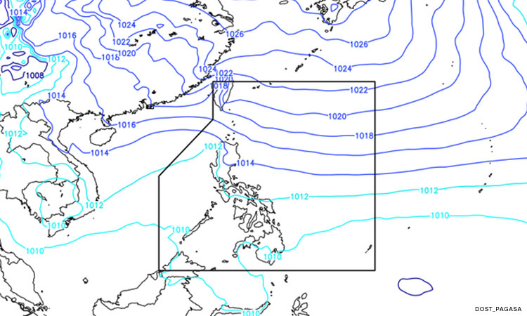

Metro Manila (CNN Philippines, January 21) — The Philippine Atmospheric, Geophysical, and Astronomical Services Administration (PAGASA) is looking at the possibility of a low-pressure area (LPA) entering the Philippine Area of Responsibility (PAR) this weekend.
The state weather bureau said Friday the LPA is forecast to enter the country by Saturday evening or early Sunday morning. It was last spotted 1,855 kilometers East Southeast of Mindanao.
PAGASA, however, noted the LPA has a low chance of developing into a storm, and has no direct impact on the country yet.
The provinces of Laguna, Quezon, and Aurora, as well as the Bicol region may experience cloudy skies with scattered rains and thunderstorms over the next 24 hours due to the shear line affecting Southern Luzon; while the Northeast Monsoon or “Amihan” may bring cloudy skies with rains to Metro Manila, Cagayan Valley, and Cordillera Administrative Region.
PAGASA said partly cloudy to cloudy skies with isolated light rains will prevail over Ilocos Region and the remaining parts of Central Luzon. The Visayas and Mindanao, and the rest of Luzon, meanwhile, will have partly cloudy to cloudy skies with isolated rain showers due to localized thunderstorms.