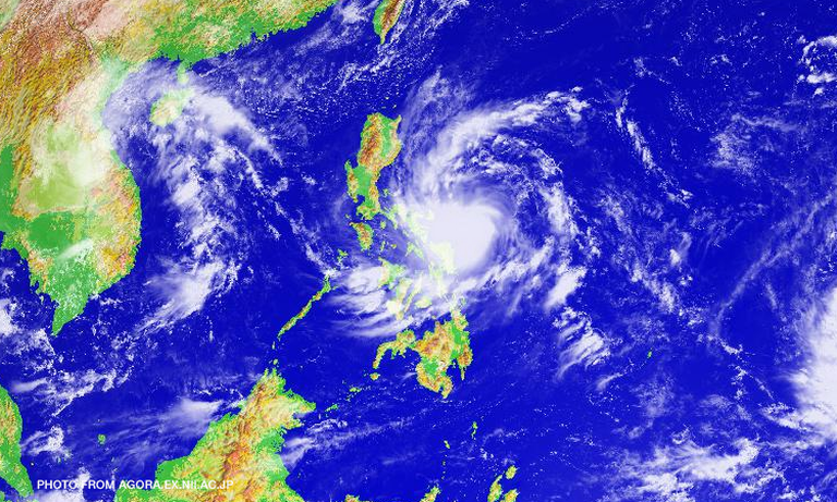

Metro Manila (CNN Philippines) — Severe tropical storm Karen (international name: Sarika) gained more strength as it moved closer to Catanduanes late Friday evening, causing the weather bureau to hoist Signal No. 3 over the island province.
Weather forecaster Meno Mendoza told CNN Philippines early Saturday morning that as of 10 p.m., Karen was packing maximum winds of up to 120 kph and gustiness of 150 kph, while maintaining its west-northwest direction still at 9 kph.
Meanwhile, Signal No. 2 had been raised in Camarines Norte and Camarines Sur.
Signal No. 1 was up in the following areas:
Metro Manila
Rizal
Batangas
Laguna
Cavite
Bulacan
Pampanga
Bataan
Zambales
Tarlac
Nueva Ecija
Nueva Vizcaya
Pangasinan
Aurora
Quirino
Albay
Sorsogon
Camarines Norte
Camarines Sur
Isabela
Romblon
Marinduque
Quezon, including Polilio Island
Masbate, including Ticao and Burias Island
Oriental Mindoro
Northern Samar
Mendoza said Karen is expected to make landfall Sunday morning or before noontime in Quezon-Aurora area.
Places within the storm’s 500-km radius will have moderate to heavy rain along with gusty winds.
Earlier in the afternoon, the Philippine Atmospheric, Geophysical and Astronomical Services Association (PAGASA) elevated tropical storm Karen to a severe tropical storm.