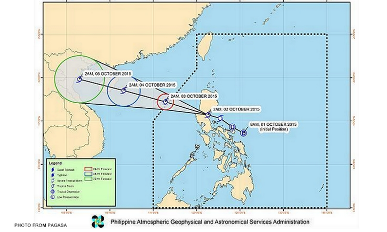

Metro Manila (CNN Philippines) — Tropical Storm Kabayan, internationally known as Mujigae, made landfall over the Baler-San Luis area of Aurora at around 2 a.m. on Friday (October 2) and, as of this writing, continues to cross Central Luzon, according to the bulletin issued at 5 a.m. by the Philippine Atmospheric, Geophysical and Astronomical Services Administration (PAGASA).
The storm retained its speed of 20 kph as it moved west-northwest, packing maximum sustained winds of 65 kph near its center, with a gustiness of up to 80 kph.
As of 4 a.m., it was in the vicinity of San Jose City, Nueva Ecija, or 60 km west of Baler.
It will bring moderate to heavy rainfall within its 300 km diameter.
There will moderate to occasionally heavy rains and isolated thunderstorms over the provinces of Cavite, Laguna, and Batangas.
PAGASA predicts that the storm will leave land Friday sometime between 9 a.m. and 11 a.m. and exit Philippine territory by Saturday between midnight and 2 a.m.
Meanwhile, PAGASA raised storm signals over several areas in Luzon:
Signal No. 2 (bringing 61 to 120 kph winds in at least 24 hours)
Aurora
Quirino
Nueva Vizcaya
Nueva Ecija
Benguet
La Union
Pangasinan
Tarlac
Signal No. 1 (bringing 30 to 60 kph winds in at least 36 hours)
Southern Isabela
Ifugao
Mountain Province
Ilocos Sur
Zambales
Pampanga
Bataan
Bulacan
Rizal
Northern Quezon including Polillo Island
Metro Manila
Residents in low lying and mountainous areas under these storm signals are advised to watch out for possible flash flooding and landslides.
Sea travel is risky over the seaboards of Northern Luzon and Central Luzon and eastern seaboard of Quezon including Polillo Island.