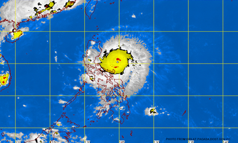

(CNN Philippines) — Typhoon Dodong slowed down on Saturday afternoon (May 9) moving west-northwest at 18 kph, from its former 20 kph, towards the coast of Isabela-Cagayan area according to the 5:00 pm bulletin released by the Philippine Atmospheric, Geophysical and Astronomical Services Administration (PAGASA).
It has maximum sustained winds of 160 kph near the center and gustiness of up to 195 kph.
As of 4:00 p.m., Dodong was spotted at 350 km east of Infanta, Quezon.
PAGASA saidit would probably make landfall over the coast of the Isabela-Cagayan area by early Sunday morning (May 10) and will exit Philippine territory by Tuesday morning Tuesday May 12.
At the moment, PAGASA said there was little chance it would raise a storm signal warning over Metro Manila, which only had some cloudy skies.
The National Disaster Risk Reduction and Management Council (NDRRMC) has been on red alert since Friday and is scheduled to release another report by 6:00 p.m.
Storm surges reaching up to 2 meters are expected in areas that are under Storm Signals No. 2 and and No. 3.
Storm Signal No. 3 is up over:
Cagayan
Isabela
northern Aurora
Storm Signal No. 2 is up over:
Calayan and Babuyan group of islands
Apayao
Kalinga
Mountain Province
Nueva Vizcaya
Ifugao
Polillo Island
Catanduanes
Quirino
the rest of Aurora
Storm Signal No. 1 is up over:
Batanes
Abra
Ilocos Sur
Ilocos norte
Benguet
Nueva Ecija
Quezon
Camarines Norte
Camarines Sur
The following are no longer under any storm signal:
Albay
Sorsogon
Northern Samar